
Recently Texas has been in the news due to an outbreak of West Nile virus in the Dallas area. Probably one of the most underutilized (perhaps under appreciated) government scientific agencies for biological work is the USGS. For mosquito borne diseases, USGS (with the CDC) has a great site called Disease Maps. These maps track the mosquito (arbo-vector) borne diseases West Nile Virus, St Loius Encephalitis, Eastern and Western Equine Encephalitis, LaCrosse Encephalitis, Powassan Virus (tick borne), and Dengue Fever in the US via several factors. Not just human cases, but also animal, mosquito (caught in flight traps) and sentinel sites ( usually a chicken in a cage in a high mosquito area near human populations). The maps are broken down by state and then county. This gives a rather good picture to see if a certain disease is in your area and the level of protection one should consider (certainly ticks, parasites, etc. should always be a consideration when outside).
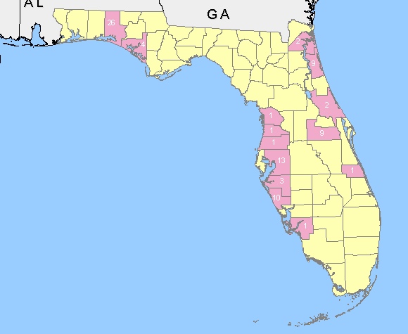
Below is a map of Florida showing the sentinel site detection for West Nile Virus in the different counties. Though several sentinel sites have detected the virus, the only human cases have been in Duval county. Conversely, in Texas, the sentinel sites have been quiet, but human cases quite high. This shows that one should check all aspects (human, sentinel, mosquito, etc.) to get a clear picture. The discrepancy may be due to several factors (not a large enough trap/sentinel site network, human error, etc.). Knowledge is power, checking as many different sources/means as possible tends to yield a more clear picture.
Take appropriate measures to ensure you are well protected while out and about. More on arboviruses go to the CDC Arbo website.
Let’s be careful out there!

encephalitis is really deadly if it is not treated early..
The latest posting provided by our new blog page
http://www.healthmedicinecentral.com/tongue-cancer-pictures/